
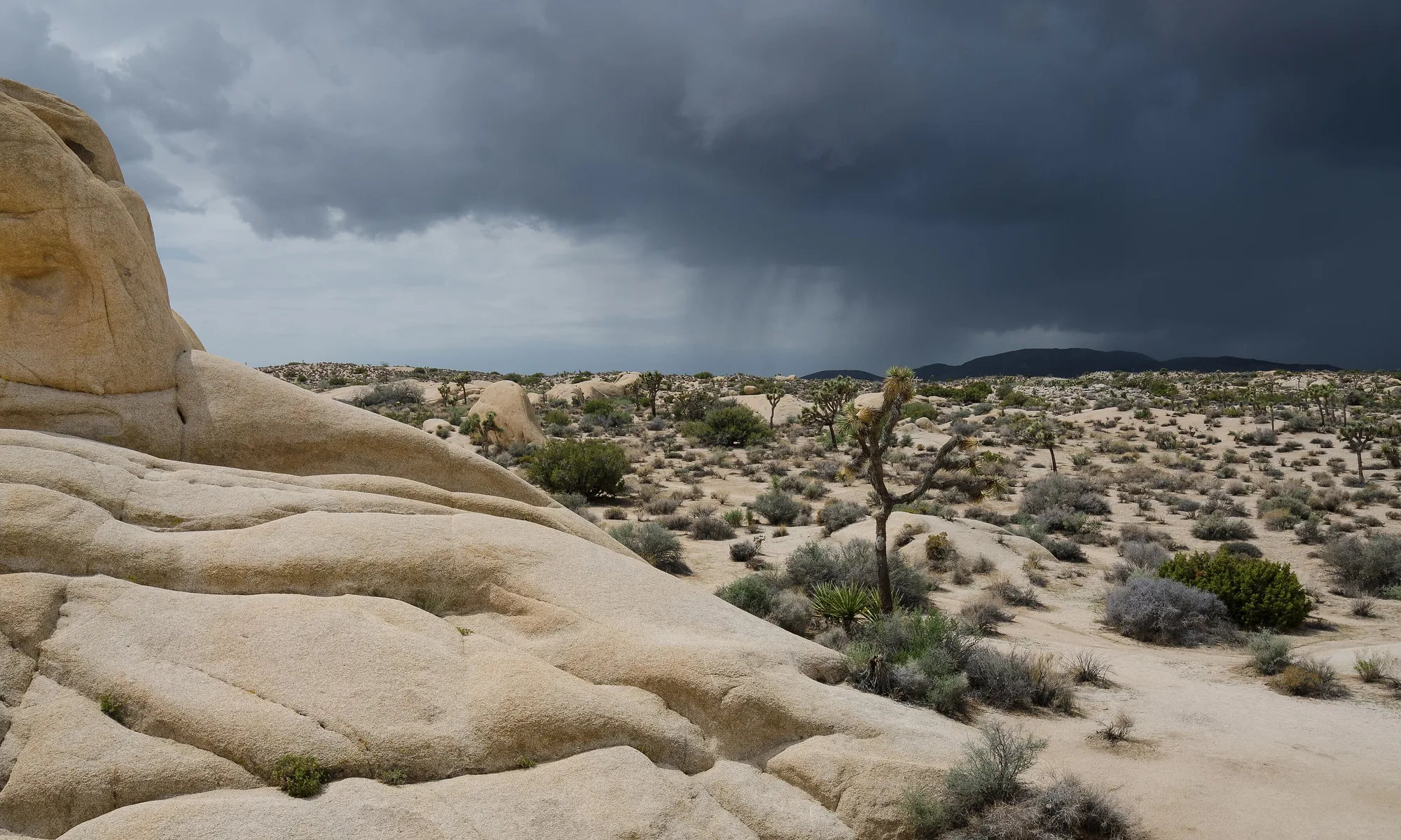
Joshua Tree
High-desert gateway to Joshua Tree National Park—sculpted boulders, namesake yuccas, stargazing skies, and a funky village of galleries and roadside motels.
Interactive map loading… View on OpenStreetMap
34.1269, -116.3183 · OSM
- Type
- city
- Region
- Deserts
- Season
- Best October, November, March
- Access
- Near PSP
About Joshua Tree
High-desert gateway to Joshua Tree National Park—sculpted boulders, namesake yuccas, stargazing skies, and a funky village of galleries and roadside motels.
Short loop among boulders and Joshua trees—ideal first stop after the west entrance. Panorama over Coachella Valley and San Andreas fault zone—sunset and clear-day smog checks matter. Iconic formations and campground scenery—easy stops between longer hikes. Dense teddy-bear cholla at sunrise—stay on boardwalks; spines are vicious.
Know before you go
- Heat: Summer interior temps exceed 100°F—carry a gallon of water per person per hike.
- No services in park: No gas or food inside boundaries—fill up in Joshua Tree or Twentynine Palms.
- Rock climbing ethics: Use established routes; desert varnish scars easily.
- Dark sky: Headlights ruin night photography—use red lights on trails.
- Wind: Spring gusts affect camping—stake tents well.
- Forecast: Desert storms flash-flood washes—check NWS on this page before remote drives.
How to get to Joshua Tree
The community of Joshua Tree sits just north of the national park’s west entrance along State Route 62 in the Morongo Basin, about 50 minutes from Palm Springs International (PSP) and roughly 90 minutes from Ontario (ONT). Most visitors drive—there is no passenger rail. Park entrances also reach from Twentynine Palms (north) and Cottonwood (south) for loop itineraries.
- Fly PSP or ONT and rent a car Desert highways are long and services sparse—carry full fuel and water before park days.
- Enter the park via Joshua Tree or Twentynine Palms West entrance near town suits Hidden Valley and Keys View; north entrance helps Skull Rock loops.
- Buy park passes online when possible Entrance lines stack holiday weekends—America the Beautiful passes work here.
- Download offline maps Cell service is patchy inside the park—GPS alone can fail on backcountry roads.
Plan your visit
Best months
October, November, March, April
Typically the most comfortable months for weather and crowds.
Nearest airport
Palm Springs International Airport (PSP)
About 50 minutes by car, depending on traffic.
Highlight
National park · Desert · Rock climbing
High-desert gateway to Joshua Tree National Park—sculpted boulders, namesake yuccas, stargazing skies, and a funky village of galleries and roadside motels.
Plan two to three nights for sunrise rock climbs, a Keys View sunset, night-sky hours, and village gallery browsing. Single-day runs from LA are possible but rushed—start pre-dawn to beat heat and crowds.
Spring rhythm: Wildflowers in wet years, comfortable hiking temps, and peak campground demand—reserve sites months ahead for March–April.
Summer rhythm: Extreme heat limits midday trails—climb or hike before 9 a.m., siesta midday, stargaze after dark.
Who it’s for: Rock climbers, photographers, national-park collectors, and desert renters seeking Airbnb cabins with fire pits.
Budget tips: National park entrance covers seven days; grocery up in Yucca Valley; bring camp meals to avoid limited village prices.
Gear checklist: Headlamps for night-sky returns, sun hats with no flyaways for wind, and a paper map backup when batteries die in the park. Town grocery stocks ice and camp fuel; fill propane before remote sites. Split park days by entrance to avoid backtracking across the whole preserve.
Joshua Tree: FAQ
Is Joshua Tree a town or a park?
Both—a small unincorporated community borders Joshua Tree National Park; most sights are inside federal land.
How far is Joshua Tree from Los Angeles?
About 130 miles east—2.5–3.5 hours via I-10 and Hwy 62 depending on traffic.
What airport is closest?
Palm Springs (PSP) is typical; Ontario (ONT) serves more airlines with a longer drive.
How many days in Joshua Tree National Park?
Two full days cover major viewpoints and one longer hike; climbers stay longer.
Can you camp?
Yes—reservable and first-come campgrounds fill spring weekends; also private glamping outside the park.
When is wildflower season?
March–April in wet years—variable; check park bloom reports.
Is summer too hot?
Daytime hiking can be dangerous June–August—use early mornings and short trails.
Do you need a 4x4?
Main paved roads suit standard cars; some dirt backroads need clearance and caution.
Are dogs allowed?
Leashed dogs are limited to roads and campgrounds—not on most trails inside the park.
What should visitors expect in Joshua Tree this fall?
October cools enough for longer hikes by mid-morning while campgrounds ease from summer heat stress. Days shorten—plan Keys View before dinner. Wind events can dust up skies; check National Park alerts and the National Weather Service forecast on this page before backcountry drives.
More places near Deserts


Nearest beaches



Photo: Wikimedia Commons