
Jenner
A blink-and-you-slow-down hamlet where the Russian River pours into the Pacific—estuary overlooks, Highway 1 coastal miles, and seal-watching pullouts between Guerneville redwoods and Fort Ross.
Interactive map loading… View on OpenStreetMap
38.4497, -123.1152 · OSM
- Type
- city
- Region
- Sonoma County
- Season
- Best May, June, September
- Access
- Near SFO
About Jenner
A blink-and-you-slow-down hamlet where the Russian River pours into the Pacific—estuary overlooks, Highway 1 coastal miles, and seal-watching pullouts between Guerneville redwoods and Fort Ross.
Roadside pullouts reveal where freshwater current meets Pacific swell—a classic North Coast geography lesson without a long hike. Link Jenner to Bodega Bay south or Fort Ross and Timber Cove north—allow extra time for photo stops and slow RV traffic. Sonoma Coast State Park beaches and bluff trails near the river mouth—verify access signs and seasonal wildlife protections. Armstrong Redwoods and river towns lie a short drive inland—pair foggy coast mornings with shaded forest afternoons. Allow extra time for parking, reservations, and seasonal crowds typical of Sonoma County destinations.
Know before you go
- Wind and fog: Marine layer and afternoon breezes are normal—pack a windbreaker even on sunny valley mornings inland.
- Wildlife distance: Seals and seabirds are sensitive to close approaches; obey posted guidance and seasonal beach closures.
- Cell coverage: Spotty on Highway 1 north of town—download offline maps before leaving Guerneville or Highway 101.
- Road conditions: Storms can trigger slides and temporary Highway 1 delays—check Caltrans before committing to a one-way coastal itinerary.
- Tides and surf: Estuary and beach access changes with conditions; this page’s water note explains sparse tide stations—use local signage at beaches.
- Services: ATMs, groceries, and lodging are limited—stock up in larger towns if you are continuing north.
- Live weather: Use the National Weather Service forecast panel on this page before hikes, boating, or long coastal walks.
- Reservations: Popular restaurants, tastings, and tours often require advance booking on weekends and holidays.
How to get to Jenner
Jenner occupies a narrow strip of Sonoma Coast Highway 1 where the Russian River meets the ocean, roughly 20 miles west of Guerneville and about two hours north of San Francisco when traffic cooperates. San Francisco (SFO) and Oakland (OAK) are the usual flight gateways listed for this page—plan 90–120 minutes to the coast via Highway 101 and River Road or the Bohemian Highway corridor, depending on whether you prioritize speed or redwood scenery.
- Fly into SFO or OAK and rent a car Coastal Sonoma has almost no useful transit to Jenner itself. Santa Rosa (STS) can shave time if you already have flights there, but most itineraries still end with a windshield view of river and fog.
- Drive west on River Road or Highway 116 From Guerneville, follow the Russian River toward the mouth. The landscape shifts from redwood shade to open estuary grass in a few miles—watch for cyclists and slow RVs on two-lane curves.
- Use Highway 1 north and south Jenner makes a natural pause between Bodega Bay to the south and Fort Ross, Timber Cove, and Sonoma Coast State Park beaches to the north. Fuel up before remote stretches; gas options are sparse on the northern coast.
- Park at river-mouth pullouts Small lots serve overlooks and the handful of cafes and inns. Sunny weekend afternoons fill quickly—arrive before midday or visit midweek for easier parking along the estuary.
Plan your visit
Best months
May, June, September, October
Typically the most comfortable months for weather and crowds.
Nearest airport
San Francisco International Airport (SFO)
About 102 minutes by car, depending on traffic.
Highlight
Sonoma Coast · Russian River · Scenic drives
A blink-and-you-slow-down hamlet where the Russian River pours into the Pacific—estuary overlooks, Highway 1 coastal miles, and seal-watching pullouts between Guerneville redwoods and Fort Ross.
Budget a few hours to half a day for estuary scenery, a relaxed meal, and short walks—then expand into Guerneville redwoods, Goat Rock Beach, or a Fort Ross history stop if you have a full coastal day.
Coastal rhythm: Morning often brings softer light on the river bar and fewer cars on Highway 1. Afternoons can turn windy and cool even in summer—layer fleece over your t-shirt before bluff walks. Winter storms dramatize surf and sometimes improve gray whale spotting from elevated pullouts when skies clear between fronts.
Wildlife watching: Harbor seals frequently haul out near the estuary. Treat them as neighbors, not photo props—stay behind fences and follow seasonal closure signs that protect pupping areas. Binoculars beat zoom lenses pressed against restricted zones.
Who it’s for: Couples on slow Highway 1 drives, photographers chasing fog and estuary reflections, and travelers linking wine country with a Pacific finish—not shoppers or nightlife seekers. Lodging is limited; many guests stay in Guerneville, Bodega Bay, or Jenner’s small inns for one quiet night.
Pairing ideas: Armstrong Redwoods and river kayaking inland, Jenner estuary lunch, then north to Fort Ross or south toward Bodega Head. A second day can cover Sonoma Coast State Park beaches with tide-aware planning—regional tide context on this page is not a substitute for on-site surf judgment.
Budget tips: Picnic supplies from Sebastopol or Santa Rosa markets stretch a coast day; restaurant seats are few and popular on holiday weekends—reserve when you can.
Practical pacing: Most visitors budget two full days for Jenner—one for signature sights and one for a slower neighborhood or outdoor block without rushing between parking lots.
Regional context: Jenner anchors Sonoma County itineraries where sonoma coast, russian river, scenic drives, wildlife show up in everyday planning. San Francisco International Airport (SFO) is the primary gateway listed here—budget roughly 102 minutes by road before traffic and stops.
Seasonal window: May, June, September, October often balance comfortable weather with event calendars—still pack layers because microclimates and elevation swings are common across California.
Who it suits: Road-trippers linking nearby towns, weekenders from major metros, and travelers who want a local base rather than only marquee attractions an hour away.
Jenner: FAQ
What is there to do in Jenner CA?
Estuary wildlife viewing, coastal pullouts, meals at local spots, and using the hamlet as a gateway for Highway 1 exploration north and south.
Is Jenner the same as the Russian River?
Jenner sits at the river’s Pacific mouth; Guerneville, Monte Rio, and other communities line the inland river corridor.
Can you see seals in Jenner?
Harbor seals are often visible near the estuary. Viewing rules and seasonal closures may apply—follow on-site signs and keep distance.
What is the closest airport to Jenner?
San Francisco (SFO) and Oakland (OAK) are typical; Santa Rosa (STS) is closer when flights fit your schedule.
Do you need a car in Jenner?
Yes—public transit is limited and attractions spread along Highway 1 and River Road.
When is the best time to visit Jenner?
May–October often brings milder coastal walking weather; clear winter days can be excellent for photography with fewer crowds.
How far is Jenner from San Francisco?
Roughly 70–80 miles by road—often about two hours without heavy traffic, longer on holiday weekends.
Can you swim at the Jenner estuary?
Cold water, currents, and wildlife protections make casual swimming uncommon—treat the estuary as a viewing and paddling environment unless a designated area clearly allows more.
How many days do you need in Jenner?
Two days cover highlights without rushing; add a third if you are pairing Jenner with neighboring Sonoma County towns or a long outdoor day.
What is Jenner known for?
Jenner is known for sonoma coast, russian river, scenic drives, wildlife within Sonoma County—use this page’s sections for how to reach airports, trails, and dining clusters.
What should visitors expect in Jenner this fall?
September and October sit in Jenner’s stronger weather window—milder afternoons than midsummer, with fog still possible at dawn. Whale migration periods can reward patient bluff watchers on clear days. Reserve scarce restaurant and inn seats on holiday weekends, pack layers for windy estuary walks, and check the live National Weather Service forecast on this page before driving remote Highway 1 segments.
More places near Sonoma County



Nearest beaches




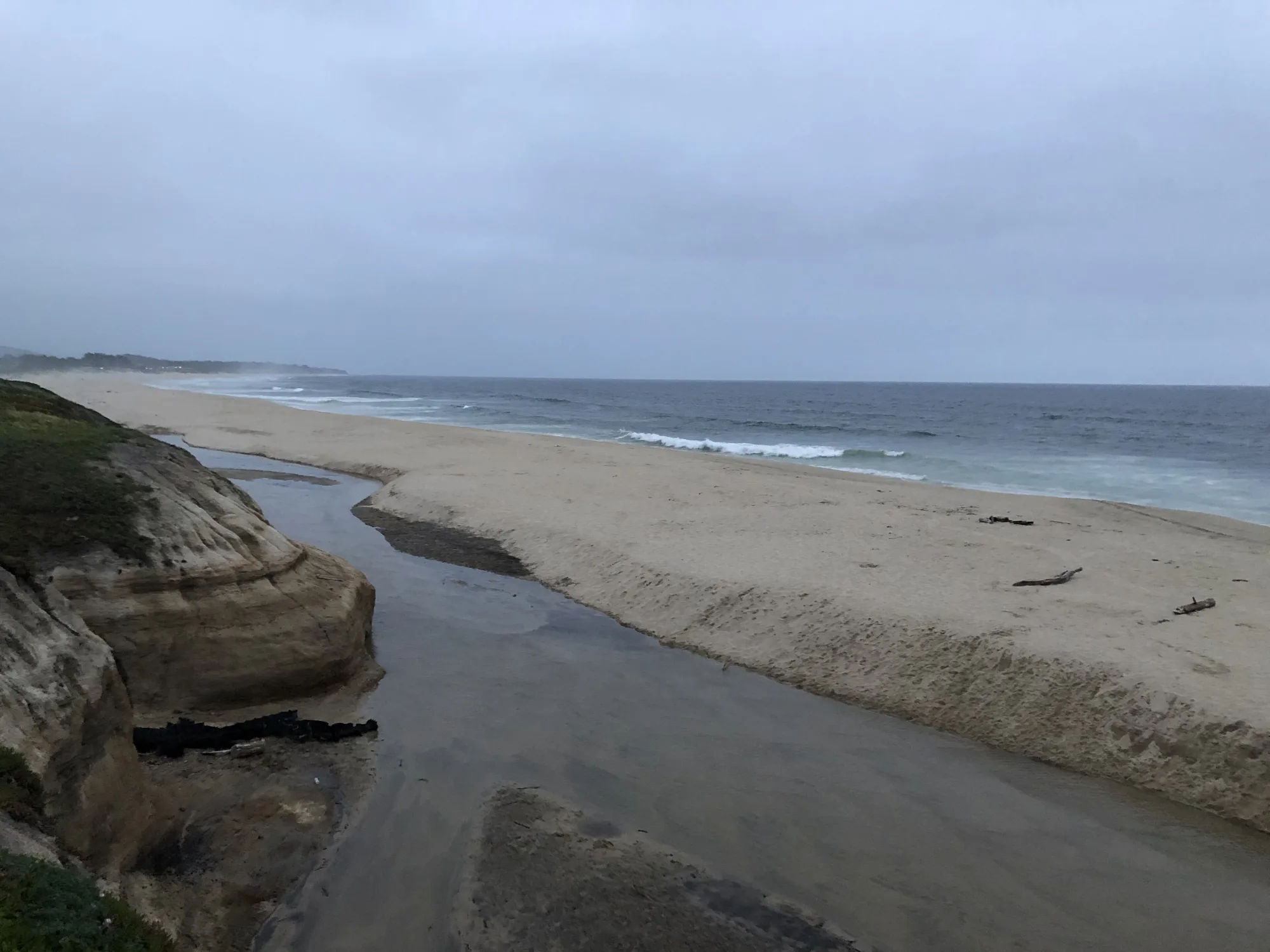

Photo: Wikimedia Commons