
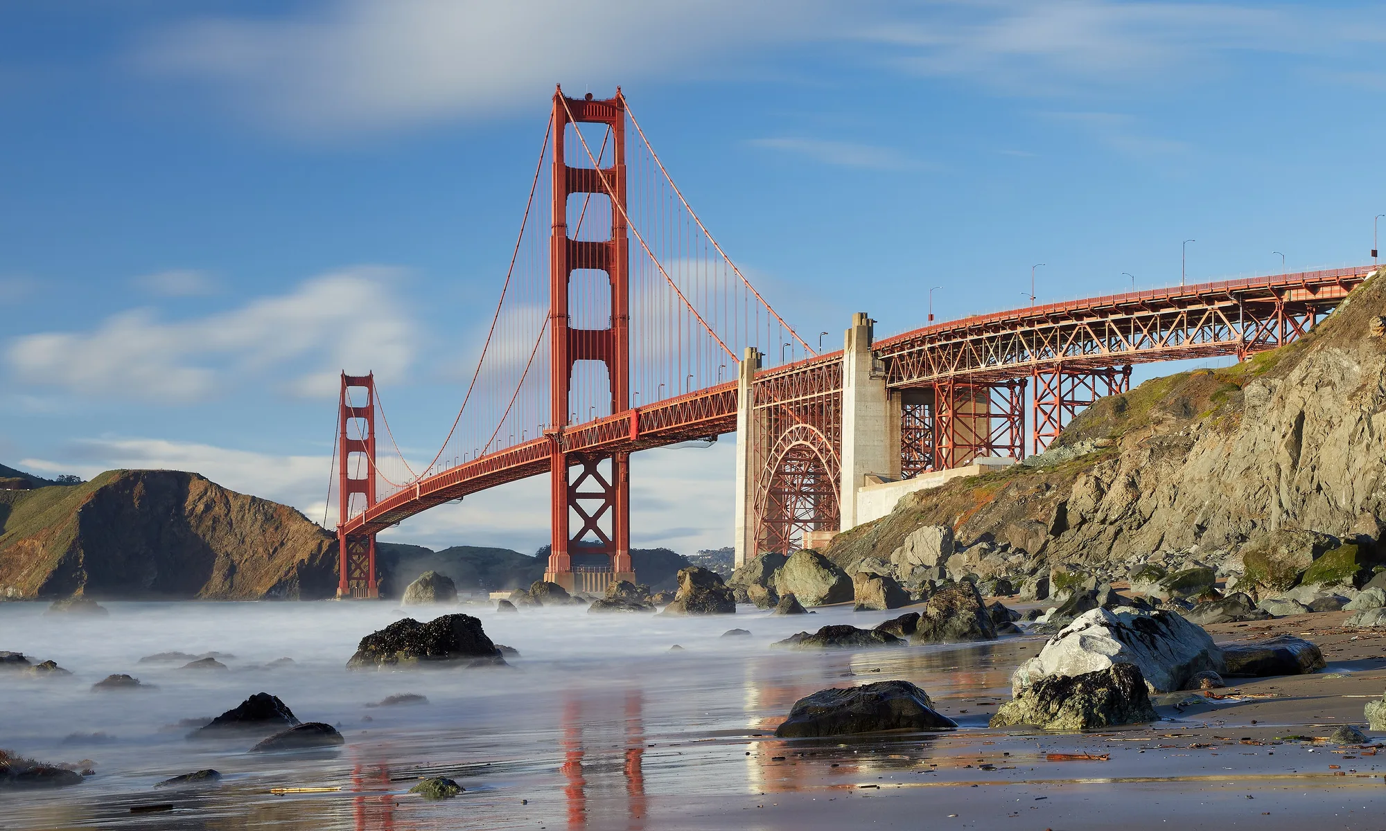
Sausalito
Marin hillside waterfront—ferry views of San Francisco, houseboat neighborhoods, gallery-lined Bridgeway, bay trails, and waterfront dining minutes from the Golden Gate.
Interactive map loading… View on OpenStreetMap
37.8591, -122.4853 · OSM
- Type
- city
- Region
- San Francisco Bay Area
- Season
- Best April, May, September
- Access
- Near SFO
About Sausalito
Marin hillside waterfront—ferry views of San Francisco, houseboat neighborhoods, gallery-lined Bridgeway, bay trails, and waterfront dining minutes from the Golden Gate.
Galleries, ice cream, and bay views along the main drag with San Francisco skyline across the water. Approach from San Francisco for skyline photos on the water—check return schedules before dinner. Colorful floating homes visible from public paths near Gate 5 Road—respect residents’ privacy. Working hydraulic model of San Francisco Bay—indoor science stop on foggy afternoons.
Know before you go
- Parking: Street and lot spaces fill on sunny weekends—arrive early or ferry in.
- Houseboat privacy: View communities from public paths; do not walk onto private docks.
- Wind & layers: Bay breezes cool sunny afternoons—bring a jacket.
- Bike traffic: Bridgeway mixes pedestrians and cyclists—walk bikes in crowded blocks if signs require.
- Muir Woods timing: Parking and entry reservations are separate from Sausalito visits—book on the NPS site.
- Ferry apps: Golden Gate Ferry schedules change seasonally—confirm last boat before a late dinner in San Francisco.
- Steep stairs: Hillside neighborhoods use long stairways—wear grippy shoes if you explore above Bridgeway.
How to get to Sausalito
Sausalito sits on the Marin County shore just north of the Golden Gate Bridge. Visitors arrive by ferry from San Francisco, car over the bridge, or bike from the city via the west-side bridge path. SFO and OAK are each about 30 minutes away in light traffic—parking downtown is often scarcer than parking in the city on sunny Saturdays.
- Take the Golden Gate Ferry Ferries from San Francisco Ferry Building or nearby terminals land near downtown Sausalito—scenic and avoids bridge parking hunts.
- Drive US-101 north Exit at Sausalito/Bridgeway after crossing the Golden Gate. Weekends bring congestion along the waterfront.
- Bike the Golden Gate Cyclists use the west-side bridge path then coast into Sausalito—popular weekend route with bike-rental returns in town.
- Walk Bridgeway and side stairs Hillside stair paths link waterfront to residential streets—wear comfortable shoes for elevation changes.
Plan your visit
Best months
April, May, September, October
Typically the most comfortable months for weather and crowds.
Nearest airport
San Francisco International Airport (SFO)
About 29 minutes by car, depending on traffic.
Highlight
Bay views · Houseboats · Ferry
Marin hillside waterfront—ferry views of San Francisco, houseboat neighborhoods, gallery-lined Bridgeway, bay trails, and waterfront dining minutes from the Golden Gate.
A half day to full day covers Bridgeway galleries, bayfront lunch, and houseboat photo walks. Pair with Muir Woods or Mount Tamalpais if you have a car and timed entry reservations where required.
Clear mornings deliver the best bridge photos; afternoons can be windy on the bay.
Who it’s for: Couples, photographers, San Francisco visitors wanting a Marin escape without a long drive.
Budget tips: Ferry round trip plus walking beats bridge tolls and waterfront parking on sunny Saturdays.
Gallery crawl: Side streets off Bridgeway hide smaller studios—pick up a map at the visitor kiosk if one is open midweek.
Drive buffer: Add thirty minutes to every scenic leg for parking, viewpoints, and unplanned photo stops—rushed Marin days skip the bay views you came for.
Sausalito: FAQ
How do you get to Sausalito from San Francisco?
Golden Gate Ferry, car over the bridge, or bike across the west sidewalk path are the common options.
Is Sausalito walkable?
Downtown Bridgeway and the waterfront are walkable; hillside neighborhoods are steep.
Can you see houseboats in Sausalito?
Yes from designated public viewing areas—do not trespass on private docks.
How far is Sausalito from SFO?
About 30 minutes north in light traffic—longer during commute peaks.
Is Sausalito good for a day trip?
Yes—half to full day covers dining, galleries, and a ferry ride without overnight stays.
What is near Sausalito?
Muir Woods, Mount Tam, Marin Headlands, and San Francisco are minutes away—plan reservations for popular parks and ferries.
Can you visit Sausalito without a car?
Yes—Golden Gate Ferry plus walking Bridgeway works well for many day-trippers; Muir Woods still needs a shuttle, tour, or rideshare from town.
What should visitors expect in Sausalito this fall?
September and October fall in the stronger window for Sausalito. Clear mornings become more common as summer fog eases, though afternoon wind still blows on Bridgeway. Ferry schedules remain robust for day-trippers—pack layers and check the live National Weather Service forecast on this page before Headlands hikes.
More places near San Francisco Bay Area


Nearest beaches



Photo: Wikimedia Commons